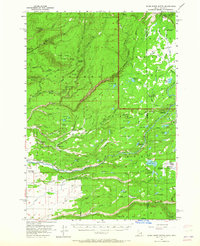
1957 Map of Warm River Butte
USGS Topo · Published 1965About this map
Yellowstone National Park and Targhee National Forest meet in this mid-century survey of the high plateau and river country along the Idaho-Wyoming border. The landscape is defined by the transition from the volcanic heights of Warm River Butte and Moose Creek Butte down into the riparian meadows and waterfalls of the Bechler River system. Remote outposts like the Bechler River Ranger Station and the Boundary Creek Patrol Cabin underscore the era's conservation efforts and wilderness management.
Find a feature on this map
84 named features on this map. Tap any name to fly to it.
Don’t see what you’re looking for? This feature index may not catch every label — zoom into the map to look around manually.
Map Details
Editions of this 1957 Warm River Butte Map
3 editions found

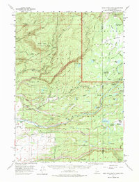
Other maps of this area

1886 · Shoshone
USGS Topo · 1:125,000

1888 · Shoshone
USGS Topo · 1:125,000

1895 · Shoshone
USGS Topo · 1:125,000

1899 · Grand Teton
USGS Topo · 1:125,000

1901 · Shoshone
USGS Topo · 1:125,000

1901 · Grand Teton
USGS Topo · 1:125,000

1908 · Shoshone
USGS Topo · 1:125,000

1911 · Shoshone
USGS Topo · 1:125,000

1955 · Ashton
USGS Topo · 1:250,000

1955 · Driggs
USGS Topo · 1:250,000