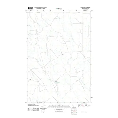
2011 Map of Becker Dam
USGS Topo · Published 2011About this map
Cedar Creek and its many tributaries, including East Fork Cedar Creek and Ash Creek, carve through this section of Prairie County, Montana. The landscape is defined by a sparse network of ranch and mountain roads, such as Big Sheep Mountain Rd and Bad Route Rd, which navigate the drainage basins of the Yellowstone River watershed. Human modification of the water system is evident in a series of small-scale impoundments and dams scattered throughout the area. Notable water management features include Spider Dam, Becker Dam, and the larger Ban Reservoir Number 1, which is fed by Ban Dam. On the western edge, the terrain levels out at Agate Flat, where the Agate Flat Dam provides essential water storage in an otherwise arid environment. This 2011 survey by the U.S. Geological Survey details the specialized infrastructure required for ranching and land management in the eastern Montana plains.
Find a feature on this map
16 named features on this map. Tap any name to fly to it.
Don’t see what you’re looking for? This feature index may not catch every label — zoom into the map to look around manually.
Map Details
Editions of this 2011 Becker Dam Map
This is the sole edition of this map. No revisions or reprints were ever made.
Other maps of this area

1953 · Miles City
USGS Topo · 1:250,000

1954 · Glendive
USGS Topo · 1:250,000

1957 · Miles City
USGS Topo · 1:250,000

1957 · Glendive
USGS Topo · 1:250,000

1958 · Miles City
USGS Topo · 1:250,000

1958 · Glendive
USGS Topo · 1:250,000

1972 · Papps Reservoir
USGS Topo · 1:24,000

1972 · Mc Cloud
USGS Topo · 1:24,000
1972 · South Fork Reservoir
USGS Topo · 1:24,000

1980 · Terry
USGS Topo · 1:100,000