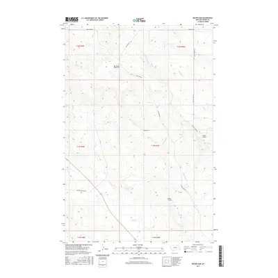
2017 Map of Becker Dam
USGS Topo · Published 2017About this map
The Big Sheep Mountains dominate this high-plains landscape in Prairie County, characterized by a complex network of coulees and seasonal watercourses. Water management is a central theme of the geography, anchored by the Becker Dam and the Ban Reservoir Number 1, which serve the needs of local ranching and agriculture in this semi-arid region. These features, along with names like Smith Coulee and Timber Coulee, reflect the enduring importance of topography and water access in eastern Montana's rural history.
Find a feature on this map
19 named features on this map. Tap any name to fly to it.
Don’t see what you’re looking for? This feature index may not catch every label — zoom into the map to look around manually.
Map Details
Editions of this 2017 Becker Dam Map
This is the sole edition of this map. No revisions or reprints were ever made.
Other maps of this area

1953 · Miles City
USGS Topo · 1:250,000

1954 · Glendive
USGS Topo · 1:250,000

1957 · Miles City
USGS Topo · 1:250,000

1957 · Glendive
USGS Topo · 1:250,000

1958 · Miles City
USGS Topo · 1:250,000

1958 · Glendive
USGS Topo · 1:250,000

1972 · Papps Reservoir
USGS Topo · 1:24,000

1972 · Mc Cloud
USGS Topo · 1:24,000
1972 · South Fork Reservoir
USGS Topo · 1:24,000

1980 · Terry
USGS Topo · 1:100,000