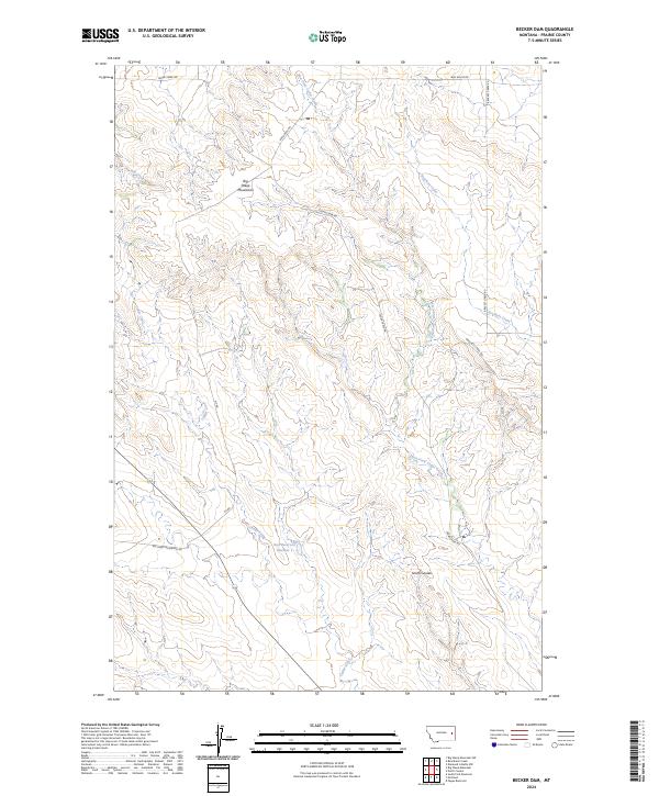
2024 Map of Becker Dam
USGS Topo · Published 2024About this map
Big Sheep Mountains dominate the western horizon of this Prairie County landscape, where the high plains are deeply incised by a network of seasonal watercourses. The drainage patterns of Cedar Creek and its tributary, East Fork Cedar Creek, define the local topography, creating a series of ridges and coulees such as Smith Coulee. Human presence in this section of eastern Montana is marked primarily by an established grid of rural access roads, including Bad Route Rd and Cedar Creek Rd, which navigate the elevation changes between the creek beds and the mountain foothills. The presence of Ban Reservoir Number 1 indicates the essential role of water management and stock ponds in this arid environment, supporting the traditional ranching and land use patterns typical of the region. This 2024 survey captures the area's current configuration of section lines and remote infrastructure.
Find a feature on this map
18 named features on this map. Tap any name to fly to it.
Don’t see what you’re looking for? This feature index may not catch every label — zoom into the map to look around manually.
Map Details
Editions of this 2024 Becker Dam Map
This is the sole edition of this map. No revisions or reprints were ever made.
Other maps of this area

1953 · Miles City
USGS Topo · 1:250,000

1954 · Glendive
USGS Topo · 1:250,000

1957 · Miles City
USGS Topo · 1:250,000

1957 · Glendive
USGS Topo · 1:250,000

1958 · Miles City
USGS Topo · 1:250,000

1958 · Glendive
USGS Topo · 1:250,000

1972 · Papps Reservoir
USGS Topo · 1:24,000

1972 · Mc Cloud
USGS Topo · 1:24,000
1972 · South Fork Reservoir
USGS Topo · 1:24,000

1980 · Terry
USGS Topo · 1:100,000