
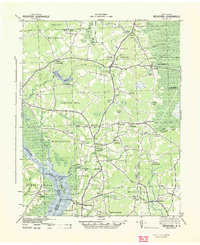
1940 Map of Beckford
USGS Topo · Published 1940About this map
The Chowan River defines the western edge of this coastal plain landscape, where the wetland environments of Lassiter Swamp and the edge of the Dismal Swamp meet an intricate network of rural crossroads. Inland, the map reveals a system of millponds and creeks, such as Merchants Millpond and Acorn Hill Mill Pond, which served as vital local economic hubs. Numerous small settlements like Sunbury, Belvidere, and Hobbsville are connected by a web of routes converging at locations such as Old Chapel Crossroads and Beckford Junction. These points of intersection and water-dependent landmarks, including Cannon Ferry near Holidays Island, illustrate the historical reliance on both river transit and overland trade routes within Gates and Chowan counties prior to modern highway development.
Find a feature on this map
69 named features on this map. Tap any name to fly to it.
Don’t see what you’re looking for? This feature index may not catch every label — zoom into the map to look around manually.
Map Details
Editions of this 1940 Beckford Map
2 editions found
Other maps of this area

1904 · Edenton
USGS Topo · 1:62,500

1906 · Hertford
USGS Topo · 1:62,500

1906 · Beckford
USGS Topo · 1:48,000

1907 · Beckford
USGS Topo · 1:62,500

1908 · Winton
USGS Topo · 1:62,500

1919 · Suffolk
USGS Topo · 1:62,500

1920 · Holland
USGS Topo · 1:62,500

1940 · Hertford
USGS Topo · 1:62,500

1940 · Lake Drummond
USGS Topo · 1:62,500

1940 · South Mills
USGS Topo · 1:62,500