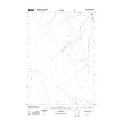
2012 Map of Beckton
USGS Topo · Published 2012About this map
Beckton serves as the primary settlement on this Sheridan County landscape, situated near the intersection of Big Horn Rd and Beckton Dr. The area's agricultural and ranching foundations are evident in the complex water management system, specifically where Ditch Number 9 draws from the surrounding creeks to navigate the varied terrain of Dry Gulch and Elk Draw.
Find a feature on this map
31 named features on this map. Tap any name to fly to it.
Don’t see what you’re looking for? This feature index may not catch every label — zoom into the map to look around manually.
Map Details
Editions of this 2012 Beckton Map
This is the sole edition of this map. No revisions or reprints were ever made.
Other maps of this area

1895 · Dayton
USGS Topo · 1:125,000

1901 · Dayton
USGS Topo · 1:125,000

1955 · Sheridan
USGS Topo · 1:250,000

1958 · Sheridan
USGS Topo · 1:250,000

1962 · Sheridan
USGS Topo · 1:250,000

1964 · Wolf
USGS Topo · 1:24,000

1964 · Dayton South
USGS Topo · 1:24,000

1964 · Walker Mountain
USGS Topo · 1:24,000

1964 · Beckton
USGS Topo · 1:24,000
1964 · Dome Lake
USGS Topo · 1:24,000