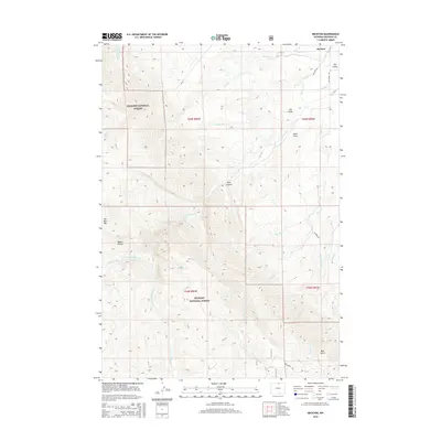
2015 Map of Beckton
USGS Topo · Published 2015About this map
Beckton and the eastern edge of the Bighorn National Forest define this 2015 landscape, where the high plains meet the foothills of the Bighorn Mountains. The map illustrates a complex drainage system flowing toward the Sheridan area, dominated by the forks of Big Goose Cr and the human-engineered Ditch Number 9. This intersection of natural watercourses and irrigation infrastructure highlights the region's reliance on managed water for agriculture and ranching.
Find a feature on this map
37 named features on this map. Tap any name to fly to it.
Don’t see what you’re looking for? This feature index may not catch every label — zoom into the map to look around manually.
Map Details
Editions of this 2015 Beckton Map
This is the sole edition of this map. No revisions or reprints were ever made.
Other maps of this area

1895 · Dayton
USGS Topo · 1:125,000

1901 · Dayton
USGS Topo · 1:125,000

1955 · Sheridan
USGS Topo · 1:250,000

1958 · Sheridan
USGS Topo · 1:250,000

1962 · Sheridan
USGS Topo · 1:250,000

1964 · Wolf
USGS Topo · 1:24,000

1964 · Dayton South
USGS Topo · 1:24,000

1964 · Walker Mountain
USGS Topo · 1:24,000

1964 · Beckton
USGS Topo · 1:24,000
1964 · Dome Lake
USGS Topo · 1:24,000