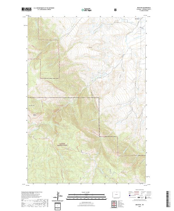
2021 Map of Beckton
USGS Topo · Published 2021About this map
The settlement of Beckton anchors the northeastern corner of this Sheridan County landscape, where the high plains begin their dramatic ascent into the Bighorn National Forest. The transition from agricultural valley to mountain wilderness is marked by an intricate network of water management and natural drainage, including Ditch Number 9 and the winding course of Big Goose Creek. This topography is defined by sharp elevation shifts, from the depths of Red Canyon to the high southern reaches of Walker Prairie.
Find a feature on this map
37 named features on this map. Tap any name to fly to it.
Don’t see what you’re looking for? This feature index may not catch every label — zoom into the map to look around manually.
Map Details
Editions of this 2021 Beckton Map
This is the sole edition of this map. No revisions or reprints were ever made.
Other maps of this area

1895 · Dayton
USGS Topo · 1:125,000

1901 · Dayton
USGS Topo · 1:125,000

1955 · Sheridan
USGS Topo · 1:250,000

1958 · Sheridan
USGS Topo · 1:250,000

1962 · Sheridan
USGS Topo · 1:250,000

1964 · Wolf
USGS Topo · 1:24,000

1964 · Dayton South
USGS Topo · 1:24,000

1964 · Walker Mountain
USGS Topo · 1:24,000

1964 · Beckton
USGS Topo · 1:24,000
1964 · Dome Lake
USGS Topo · 1:24,000