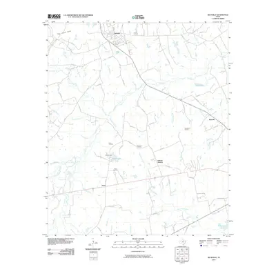
2010 Map of Beckville
USGS Topo · Published 2010About this map
Beckville serves as the primary hub of this East Texas landscape, where a complex network of county roads branches out into the surrounding piney woods and creek bottoms. The area is defined by its numerous small burial grounds, including Langley Cemetery, Walton Cemetery, and Macedonia Cemetery, which offer valuable locations for genealogists tracing local family histories. Smaller settlements like Holland Quarters and Riderville are situated along these transit corridors, reflecting a decentralized pattern of community development.
Find a feature on this map
73 named features on this map. Tap any name to fly to it.
Don’t see what you’re looking for? This feature index may not catch every label — zoom into the map to look around manually.
Map Details
Editions of this 2010 Beckville Map
This is the sole edition of this map. No revisions or reprints were ever made.
Other maps of this area

1956 · Tyler
USGS Topo · 1:250,000

1958 · Darco
USGS Topo · 1:62,500

1958 · Carthage
USGS Topo · 1:62,500

1958 · Tatum
USGS Topo · 1:62,500

1960 · Minden
USGS Topo · 1:62,500

1983 · Grand Bluff
USGS Topo · 1:24,000

1983 · Tatum
USGS Topo · 1:24,000

1983 · Harris Chapel
USGS Topo · 1:24,000

1983 · Long Branch
USGS Topo · 1:24,000

1983 · Fair Play
USGS Topo · 1:24,000