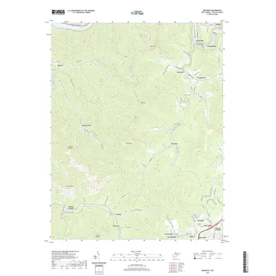
2019 Map of Beckwith
USGS Topo · Published 2019About this map
Oak Hill and Fayetteville anchor this 2019 survey of the West Virginia coalfields, showing the industrial and residential patterns of the plateau. The landscape is defined by the sharp descent from the Oak Hill plateau into the deep hollows of Beards Fork and Ingram Branch, where the Norfolk and Western Railway still traces the lower creek beds. Local history and genealogy are preserved through several family and community burial grounds, including the Abbot Cem near Beckwith and the John Nugen Cem near Dempsey. To the north, the terrain drops steeply toward the Kanawha River and the New River, connected by the Charles C Rogers Bridge. The map captures the continued significance of historic corridors like the Midland Trl and the dense network of coal-town settlements such as Lochgelly, Summerlee, and Harlem Heights.
Find a feature on this map
104 named features on this map. Tap any name to fly to it.
Don’t see what you’re looking for? This feature index may not catch every label — zoom into the map to look around manually.
Map Details
Editions of this 2019 Beckwith Map
This is the sole edition of this map. No revisions or reprints were ever made.
Other maps of this area

1891 · Raleigh
USGS Topo · 1:125,000

1897 · Kanawha Falls
USGS Topo · 1:125,000

1897 · Raleigh
USGS Topo · 1:125,000

1900 · Kanawha Falls
USGS Topo · 1:125,000

1901 · Kanawha Falls
USGS Topo · 1:125,000

1902 · Raleigh
USGS Topo · 1:125,000

1908 · Fayetteville
USGS Topo · 1:48,000

1908 · Montgomery
USGS Topo · 1:48,000

1910 · Fayetteville
USGS Topo · 1:62,500

1910 · Montgomery
USGS Topo · 1:62,500