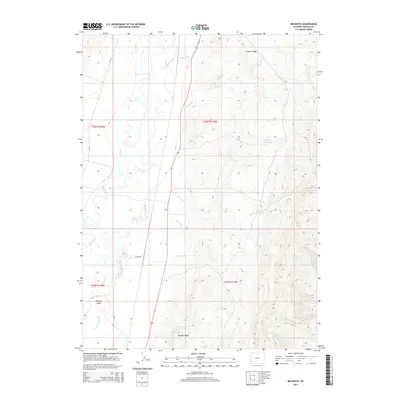
2015 Map of Beckwith
USGS Topo · Published 2015About this map
Bear River dominates the western reaches of this Lincoln County landscape, meandering through a valley defined by an extensive network of irrigation infrastructure. The small settlement of Beckwith is positioned near the river, situated between McFarland Ditch and the primary flow of the Bear River. This 2015 survey illustrates how the high desert terrain is managed for water, featuring prominent engineered waterways like the Pixley Ditch, Mau Ditch, and the long Covey Canal that skirts the base of the eastern uplands.
Find a feature on this map
22 named features on this map. Tap any name to fly to it.
Don’t see what you’re looking for? This feature index may not catch every label — zoom into the map to look around manually.
Map Details
Editions of this 2015 Beckwith Map
This is the sole edition of this map. No revisions or reprints were ever made.
Other maps of this area

1909 · Montpelier
USGS Topo · 1:125,000

1911 · Montpelier
USGS Topo · 1:125,000

1912 · Randolph
USGS Topo · 1:125,000

1936 · Cokeville
USGS Topo · 1:96,000

1942 · Cokeville
USGS Topo · 1:125,000

1954 · Sage
USGS Topo · 1:62,500

1954 · Ogden
USGS Topo · 1:250,000

1955 · Preston
USGS Topo · 1:250,000

1958 · Ogden
USGS Topo · 1:250,000

1958 · Preston
USGS Topo · 1:250,000