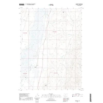
2017 Map of Beckwith
USGS Topo · Published 2017About this map
Bear River dominates the western valley floor of this Lincoln County landscape, winding through a complex network of wetlands and agricultural infrastructure. The settlement at Beckwith sits at the base of Boulder Ridge, where the flat river bottom meets the rising eastern highlands. This area is defined by its sophisticated water management system, featuring numerous man-made waterways like Pixley Ditch, Mau Ditch, and the Covey Canal that divert water from the river and its tributaries to support high-altitude ranching. Beyond the irrigated lowlands, the terrain climbs sharply toward prominent landmarks such as Stoffer Ridge and The Big Knob, revealing a landscape of deep canyons carved by Horse Cr and Leeds Cr. The contrast between the saturated wetlands of the river basin and the arid, uplifted ridges illustrates the vital role of water rights and engineering in the development of Wyoming's high desert country.
Find a feature on this map
21 named features on this map. Tap any name to fly to it.
Don’t see what you’re looking for? This feature index may not catch every label — zoom into the map to look around manually.
Map Details
Editions of this 2017 Beckwith Map
This is the sole edition of this map. No revisions or reprints were ever made.
Other maps of this area

1909 · Montpelier
USGS Topo · 1:125,000

1911 · Montpelier
USGS Topo · 1:125,000

1912 · Randolph
USGS Topo · 1:125,000

1936 · Cokeville
USGS Topo · 1:96,000

1942 · Cokeville
USGS Topo · 1:125,000

1954 · Sage
USGS Topo · 1:62,500

1954 · Ogden
USGS Topo · 1:250,000

1955 · Preston
USGS Topo · 1:250,000

1958 · Ogden
USGS Topo · 1:250,000

1958 · Preston
USGS Topo · 1:250,000