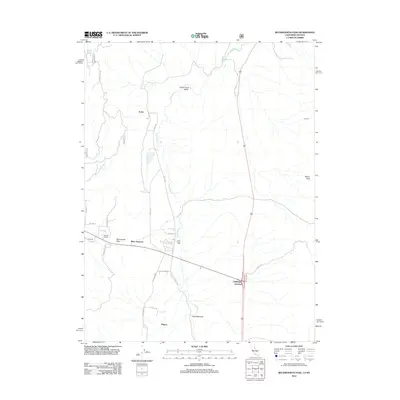
2012 Map of Beckwourth Pass
USGS Topo · Published 2012About this map
Beckwourth Pass serves as a critical geographic marker in this high-altitude corridor of Plumas County, where the Sierra Nevada meets the Great Basin. This 2012 survey captures a landscape defined by its transit history and sparse ranching settlements. The intersection of major mountain routes is anchored by Reno Junction and Hallelujah Junction, points that have long facilitated movement between California and Nevada. The infrastructure of the region is further evidenced by the Chilcoot Tunnel and the nearby Summit, indicating the significant engineering required to traverse this portion of the range.
Find a feature on this map
28 named features on this map. Tap any name to fly to it.
Don’t see what you’re looking for? This feature index may not catch every label — zoom into the map to look around manually.
Map Details
Editions of this 2012 Beckwourth Pass Map
This is the sole edition of this map. No revisions or reprints were ever made.
Other maps of this area

1890 · Sierraville
USGS Topo · 1:125,000

1891 · Reno
USGS Topo · 1:125,000

1892 · Sierraville
USGS Topo · 1:125,000

1893 · Reno
USGS Topo · 1:125,000

1894 · Sierraville
USGS Topo · 1:125,000

1950 · Chilcoot
USGS Topo · 1:62,500

1950 · Reno
USGS Topo · 1:62,500

1951 · Reno
USGS Topo · 1:62,500

1955 · Loyalton
USGS Topo · 1:62,500

1957 · Dogskin Mountain
USGS Topo · 1:62,500