
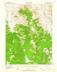
1955 Map of Loyalton
USGS Topo · Published 1957About this map
Loyalton sits at the edge of a high-altitude basin where the Western Pacific railroad skirts the northern Sierra Nevada. This 1950s landscape is defined by the heavy timber and grazing resources of the Tahoe National Forest and Toiyabe National Forest. The map documents a network of rugged access routes, including the Staverville Road and the historic Henness Pass Road, which served as a vital freight corridor during the regional mining booms. Remote outposts such as Balls Ranch, Clover Valley Ranch, and Wheelers Sheep Camp illustrate the era's reliance on open-range ranching and seasonal livestock management.
Find a feature on this map
80 named features on this map. Tap any name to fly to it.
Don’t see what you’re looking for? This feature index may not catch every label — zoom into the map to look around manually.
Map Details
Editions of this 1955 Loyalton Map
4 editions found
Other maps of this area

1890 · Sierraville
USGS Topo · 1:125,000

1891 · Carson
USGS Topo · 1:125,000

1891 · Truckee
USGS Topo · 1:125,000

1891 · Reno
USGS Topo · 1:125,000

1892 · Sierraville
USGS Topo · 1:125,000

1893 · Carson
USGS Topo · 1:125,000

1893 · Truckee
USGS Topo · 1:125,000

1893 · Reno
USGS Topo · 1:125,000

1894 · Sierraville
USGS Topo · 1:125,000

1895 · Truckee
USGS Topo · 1:125,000