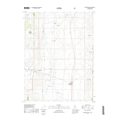
2018 Map of Beckwourth Pass
USGS Topo · Published 2018About this map
Beckwourth Pass serves as a critical transition point between the Sierra Nevada and the Great Basin, marking a lower-elevation crossing that has historically guided transit through this part of the Plumas and Lassen County borderlands. The 2018 survey reveals a landscape where high-mountain features like Snow Lake and the Plumas National Forest give way to the broad drainage of Upper Long Valley. The settlement at Hallelujah Junction sits at the intersection of modern transit routes, while the Chilcoot Tunnel represents the engineering required to navigate this terrain. Long-standing local landmarks such as Scotts and named family routes like Conkey Ln and Dutchman Rd suggest the enduring presence of ranching and rural habitation in these high-altitude valleys.
Find a feature on this map
31 named features on this map. Tap any name to fly to it.
Don’t see what you’re looking for? This feature index may not catch every label — zoom into the map to look around manually.
Map Details
Editions of this 2018 Beckwourth Pass Map
This is the sole edition of this map. No revisions or reprints were ever made.
Other maps of this area

1890 · Sierraville
USGS Topo · 1:125,000

1891 · Reno
USGS Topo · 1:125,000

1892 · Sierraville
USGS Topo · 1:125,000

1893 · Reno
USGS Topo · 1:125,000

1894 · Sierraville
USGS Topo · 1:125,000

1950 · Chilcoot
USGS Topo · 1:62,500

1950 · Reno
USGS Topo · 1:62,500

1951 · Reno
USGS Topo · 1:62,500

1955 · Loyalton
USGS Topo · 1:62,500

1957 · Dogskin Mountain
USGS Topo · 1:62,500