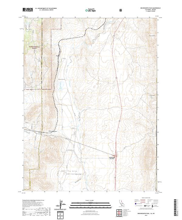
2021 Map of Beckwourth Pass
USGS Topo · Published 2021About this map
Beckwourth Pass serves as a critical geographic marker in this high-altitude landscape where the Sierra Nevada meets the Great Basin. This recent survey captures the sparse settlement patterns along the California and Nevada border, anchored by the crossroads of Hallelujah Junction and Reno Junction. The terrain is defined by the sharp transition from the wooded slopes of the Plumas National Forest to the open expanses of Upper Long Valley and the drainage of Long Valley Cr. Local road networks like Scott Rd and Hallelujah Dr reflect the area's continued use as a transit corridor, while features like Petersen Mtn and Yellow Rock dominate the eastern skyline. For researchers, the map provides precise locations for modern rural developments and the persistent natural landmarks that have guided travelers through this pass for generations.
Find a feature on this map
30 named features on this map. Tap any name to fly to it.
Don’t see what you’re looking for? This feature index may not catch every label — zoom into the map to look around manually.
Map Details
Editions of this 2021 Beckwourth Pass Map
This is the sole edition of this map. No revisions or reprints were ever made.
Other maps of this area

1890 · Sierraville
USGS Topo · 1:125,000

1891 · Reno
USGS Topo · 1:125,000

1892 · Sierraville
USGS Topo · 1:125,000

1893 · Reno
USGS Topo · 1:125,000

1894 · Sierraville
USGS Topo · 1:125,000

1950 · Chilcoot
USGS Topo · 1:62,500

1950 · Reno
USGS Topo · 1:62,500

1951 · Reno
USGS Topo · 1:62,500

1955 · Loyalton
USGS Topo · 1:62,500

1957 · Dogskin Mountain
USGS Topo · 1:62,500