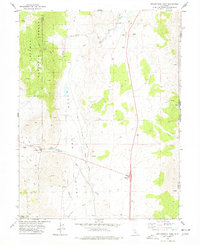
1975 Map of Beckwourth Pass
USGS Topo · Published 1977About this map
Beckwourth Pass serves as a critical geographic gateway through the Sierra Nevada, documented here in the mid-1970s. The terrain is defined by the expansive Upper Long Valley and the crossing of the Western Pacific Railroad, which pierces the ridge through the Beckwourth Pass Tunnel. The map illustrates the region's transport and industrial evolution, from the active rail line and highway hub at Hallelujah Junction to remnants of earlier infrastructure like the Old RR Grade. Small-scale extractive operations including a Strip Mine and a Gravel Pit are scattered across the valley floor near the Lassen and Plumas county lines. Traces of pioneer and ranching history are evident in the Pacific Cattle Trail and the settlement at Scotts, providing a detailed look at this high-altitude corridor.
Find a feature on this map
30 named features on this map. Tap any name to fly to it.
Don’t see what you’re looking for? This feature index may not catch every label — zoom into the map to look around manually.
Map Details
Editions of this 1975 Beckwourth Pass Map
This is the sole edition of this map. No revisions or reprints were ever made.
Other maps of this area

1890 · Sierraville
USGS Topo · 1:125,000

1891 · Reno
USGS Topo · 1:125,000

1892 · Sierraville
USGS Topo · 1:125,000

1893 · Reno
USGS Topo · 1:125,000

1894 · Sierraville
USGS Topo · 1:125,000

1950 · Chilcoot
USGS Topo · 1:62,500

1950 · Reno
USGS Topo · 1:62,500

1951 · Reno
USGS Topo · 1:62,500

1955 · Loyalton
USGS Topo · 1:62,500

1957 · Dogskin Mountain
USGS Topo · 1:62,500