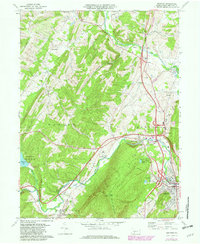
1971 Map of Bedford
USGS Topo · Published 1982About this map
The Junia Ta River and the Raystown Branch converge just outside the historic borough of Bedford, a critical junction in the ridge-and-valley landscape of Bedford County. This 1971 survey captures the area as the Pennsylvania Turnpike and Conrail lines facilitated mid-century commerce, weaving through established rural communities like Wolfsburg, Cessna, and Manns Choice. High-elevation landmarks such as Kinton Knob on Wills Mountain overlook a valley floor dotted with local institutions, from the Fairgrounds and Bedford Airport to several country churches including St Johns Ch and St Pauls Ch.
Find a feature on this map
55 named features on this map. Tap any name to fly to it.
Don’t see what you’re looking for? This feature index may not catch every label — zoom into the map to look around manually.
Map Details
Editions of this 1971 Bedford Map
3 editions found
Other maps of this area

1900 · Everett
USGS Topo · 1:62,500

1902 · Everett
USGS Topo · 1:62,500

1908 · Bedford
USGS Topo · 1:62,500

1910 · Bedford
USGS Topo · 1:62,500

1927 · Clearville
USGS Topo · 1:48,000

1927 · Hyndman
USGS Topo · 1:62,500

1931 · Clearville
USGS Topo · 1:62,500

1931 · Hyndman
USGS Topo · 1:62,500

1944 · Hyndman
USGS Topo · 1:62,500

1944 · Clearville
USGS Topo · 1:62,500