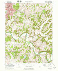
1978 Map of Bedford East
USGS Topo · Published 1979About this map
Bedford serves as the primary urban center in this late 1970s survey, showing a landscape defined by its limestone heritage and the meandering paths of the East Fork White River. The map captures the city's infrastructure at a point of maturity, including the Courthouse, Dunn Memorial Hospital, and several schools like Stalker School and Madden School. Beyond the city limits, the terrain transitions into the hills of Shawswick and Guthrie townships, where small rural pockets like Buddha and Rabbitville persist alongside significant family landmarks.
Find a feature on this map
63 named features on this map. Tap any name to fly to it.
Don’t see what you’re looking for? This feature index may not catch every label — zoom into the map to look around manually.
Map Details
Editions of this 1978 Bedford East Map
2 editions found
Other maps of this area

1934 · Bedford
USGS Topo · 1:48,000

1935 · Oolitic
USGS Topo · 1:48,000

1937 · Bedford
USGS Topo · 1:62,500

1942 · Oolitic
USGS Topo · 1:62,500

1949 · Georgia
USGS Topo · 1:24,000

1950 · Mitchell
USGS Topo · 1:24,000

1951 · Georgia
USGS Topo · 1:24,000

1956 · Vincennes
USGS Topo · 1:250,000

1957 · Vincennes
USGS Topo · 1:250,000
1957 · Oolitic
USGS Topo · 1:24,000