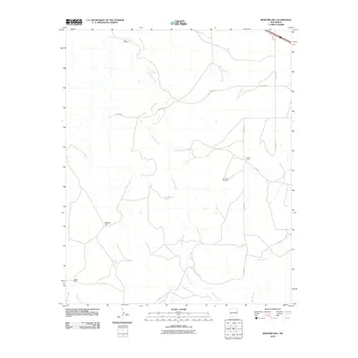
2010 Map of Bedford Hill
USGS Topo · Published 2010About this map
Revuelto Creek and its many winding tributaries define the drainage patterns of this high-plains landscape in eastern Quay County. The terrain is characterized by cattle ranching infrastructure and isolated landmarks, such as Bedford Hill and Mesa Windmill. Local land use is centered around water management and ranching, evidenced by features like the Joe Keyes Tank and established holdings including the Wooten Ranch and Wallace Ranch. The presence of Rte 66 in the northeastern corner provides a connection to the historic automotive corridor, while a grid of numbered roads like Quay Road 57 and Quay Road 58 serves the sparse population. Other waterways, including San Jon Creek, Saladito Creek, and Apache Creek, cut through the plains, supporting the local agricultural and ranching economy in this arid region.
Find a feature on this map
19 named features on this map. Tap any name to fly to it.
Don’t see what you’re looking for? This feature index may not catch every label — zoom into the map to look around manually.
Map Details
Editions of this 2010 Bedford Hill Map
This is the sole edition of this map. No revisions or reprints were ever made.
Other maps of this area

1930 · Tucumcari
USGS Topo · 1:125,000

1954 · Tucumcari
USGS Topo · 1:250,000

1954 · Clovis
USGS Topo · 1:250,000

1958 · Clovis
USGS Topo · 1:250,000

1958 · Tucumcari
USGS Topo · 1:250,000

1968 · Porter
USGS Topo · 1:24,000

1968 · San Jon
USGS Topo · 1:24,000

1968 · San Jon NW
USGS Topo · 1:24,000

1968 · Lesbia
USGS Topo · 1:24,000

1968 · Bedford Hill
USGS Topo · 1:24,000