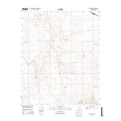
2013 Map of Bedford Hill
USGS Topo · Published 2013About this map
Revuelto Creek meanders through the heart of this High Plains landscape, carving a distinct drainage pattern through the arid terrain of Quay County. This 2013 survey illustrates a rural ranching environment where water management is central to the land's utility, marked by features such as Joe Keyes Tank and the perennial Bedford Spring. The topographic rise of Bedford Hill stands as a prominent landmark in the southwestern quadrant, while the distribution of Mesa Windmill and Champion Windmill indicates the ongoing reliance on groundwater for livestock. A network of section-line roads, including Quay Road 57 and Quay Road V, connects established local holdings like the Wooten Ranch and Wallace Ranch. The map also captures the headwaters of several intermittent streams, including San Jon Cr and Saladito Cr, which define the local watershed.
Find a feature on this map
25 named features on this map. Tap any name to fly to it.
Don’t see what you’re looking for? This feature index may not catch every label — zoom into the map to look around manually.
Map Details
Editions of this 2013 Bedford Hill Map
This is the sole edition of this map. No revisions or reprints were ever made.
Other maps of this area

1930 · Tucumcari
USGS Topo · 1:125,000

1954 · Tucumcari
USGS Topo · 1:250,000

1954 · Clovis
USGS Topo · 1:250,000

1958 · Clovis
USGS Topo · 1:250,000

1958 · Tucumcari
USGS Topo · 1:250,000

1968 · Porter
USGS Topo · 1:24,000

1968 · San Jon
USGS Topo · 1:24,000

1968 · San Jon NW
USGS Topo · 1:24,000

1968 · Lesbia
USGS Topo · 1:24,000

1968 · Bedford Hill
USGS Topo · 1:24,000