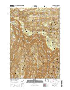
2014 Map of Bedford Point
USGS Topo · Published 2014About this map
Bedford Point and the high ridges of the Mount Hood National Forest dominate this landscape southeast of Estacada. The drainage system of the Clackamas River and its major tributaries, including the S Fork Clackamas River and N Fork Clackamas River, dictates the rugged topography. Human activity in this timbered region is marked by the utility infrastructure at the Portland General Electric Promontory Park Boat Ramp and the network of forest development roads such as Nat For Dev Rd Road 45. Notable local terrain features like La Dee Flat and Big Cliff provide context for the steep canyons, while numerous water sources including Cold Spring and Small Fry Lake highlight the area's hydrology. The map preserves the 21st-century alignment of the Clackamas Hwy as it snakes through the river valley near Mongrel Ridge.
Find a feature on this map
37 named features on this map. Tap any name to fly to it.
Don’t see what you’re looking for? This feature index may not catch every label — zoom into the map to look around manually.
Map Details
Editions of this 2014 Bedford Point Map
This is the sole edition of this map. No revisions or reprints were ever made.
Other maps of this area

1911 · Boring
USGS Topo · 1:48,000

1914 · Boring
USGS Topo · 1:62,500

1916 · Estacada
USGS Topo · 1:125,000

1940 · Boring
USGS Topo · 1:62,500

1948 · Vancouver
USGS Topo · 1:250,000

1950 · Vancouver
USGS Topo · 1:250,000

1950 · Vancouver
USGS Topo · 1:250,000
1954 · Estacada
USGS Topo · 1:24,000

1955 · Colton
USGS Topo · 1:62,500

1955 · Cherryville
USGS Topo · 1:62,500