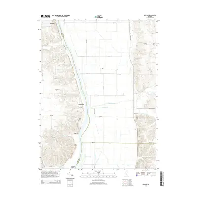
2015 Map of Bedford
USGS Topo · Published 2015About this map
The Illinois River serves as the central artery for this portion of Pike and Scott counties, dividing the flat river bottomlands from the higher bluffs to the west. Small riverside settlements like Montezuma and Bedford are situated along the western bank, where the topography rises sharply toward Pilot Knob. The map reveals a landscape heavily shaped by water management, featuring Morgan Slough and a system of drainage including Bucks Branch and Little Sandy Cr. Genealogists will find significant value in the distribution of family and community burial sites scattered throughout the terrain, such as the Adams Family Cem, Clemmons Cem, and Frame Cem. This survey illustrates the modern road network, including the Eldred-Hillview corridor and numerous township roads that provide access to the agricultural tracts bordering the river.
Find a feature on this map
55 named features on this map. Tap any name to fly to it.
Don’t see what you’re looking for? This feature index may not catch every label — zoom into the map to look around manually.
Map Details
Editions of this 2015 Bedford Map
This is the sole edition of this map. No revisions or reprints were ever made.
Other maps of this area

1924 · Winchester
USGS Topo · 1:48,000

1924 · Roodhouse
USGS Topo · 1:62,500

1924 · Griggsville
USGS Topo · 1:62,500

1926 · Griggsville
USGS Topo · 1:62,500

1926 · Winchester
USGS Topo · 1:62,500

1926 · Roodhouse
USGS Topo · 1:62,500

1930 · Pearl
USGS Topo · 1:62,500

1948 · Quincy
USGS Topo · 1:250,000

1950 · Pearl
USGS Topo · 1:62,500

1956 · Quincy
USGS Topo · 1:250,000