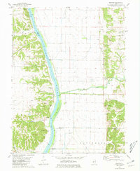
1980 Map of Bedford
USGS Topo · Published 1981About this map
The Illinois River bisects this 1980s landscape, marking the boundary between the bottomlands of Pike Co and the uplands of Scott Co. Along the western bank, the small river settlements of Montezuma and Bedford are situated near the mouth of Bedford Creek and the expansive McEvers Island. This riverfront character is further defined by a public Boat Ramp and the Pumping Station infrastructure essential for managing the floodplain.
Find a feature on this map
31 named features on this map. Tap any name to fly to it.
Don’t see what you’re looking for? This feature index may not catch every label — zoom into the map to look around manually.
Map Details
Editions of this 1980 Bedford Map
This is the sole edition of this map. No revisions or reprints were ever made.
Other maps of this area

1924 · Winchester
USGS Topo · 1:48,000

1924 · Roodhouse
USGS Topo · 1:62,500

1924 · Griggsville
USGS Topo · 1:62,500

1926 · Griggsville
USGS Topo · 1:62,500

1926 · Winchester
USGS Topo · 1:62,500

1926 · Roodhouse
USGS Topo · 1:62,500

1930 · Pearl
USGS Topo · 1:62,500

1948 · Quincy
USGS Topo · 1:250,000

1950 · Pearl
USGS Topo · 1:62,500

1956 · Quincy
USGS Topo · 1:250,000