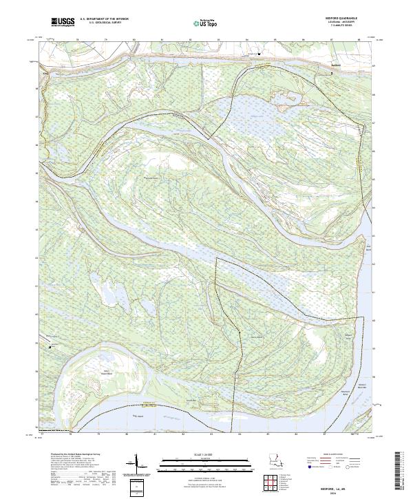
2024 Map of Bedford
USGS Topo · Published 2024About this map
Davis Island dominates this stretch of the Mississippi River where the state lines of Louisiana and Mississippi follow the winding, historic path of the water. The landscape is defined by the hydrologic shifts of the river, marked by oxbows and secondary channels like Palmyra Lake and Palmyra Chute. Small settlements and landing points such as Bedford and King sit along the periphery of these massive bends. Local history is anchored by several family and community burial grounds, including Crystal Springs Cem, Brierfield Cem, and Hodges Cem. The terrain is a complex network of bayous and drainage canals, such as Roundaway Bayou and Hodges Canal, illustrating the ongoing effort to manage the alluvial plains. This survey captures a remote riverfront environment where island bars like Newton Bend Bar and Ursino Bar continue to shift with the current.
Find a feature on this map
48 named features on this map. Tap any name to fly to it.
Don’t see what you’re looking for? This feature index may not catch every label — zoom into the map to look around manually.
Map Details
Editions of this 2024 Bedford Map
This is the sole edition of this map. No revisions or reprints were ever made.
Other maps of this area

1909 · Mound
USGS Topo · 1:24,000

1910 · Mound
USGS Topo · 1:31,680

1918 · Vicksburg
USGS Topo · 1:62,500

1939 · Talla Bena
USGS Topo · 1:62,500

1939 · Yokena
USGS Topo · 1:62,500

1941 · Vicksburg
USGS Topo · 1:62,500

1955 · Jackson
USGS Topo · 1:250,000

1961 · Jackson
USGS Topo · 1:250,000

1962 · Jackson
USGS Topo · 1:250,000

1962 · Vicksburg West
USGS Topo · 1:24,000