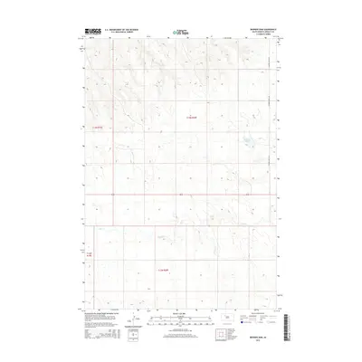
2015 Map of Bedners Dam
USGS Topo · Published 2015About this map
Elm Cr meanders across this prairie landscape of the Great Plains, defining the drainage patterns through southern Ziebach County. The 2015 topography shows a region primarily organized by the Public Land Survey System, with the section lines of t13n r20e and t12n r20e framing the vast open ranges of South Dakota. The most prominent water feature is Bedners Dam, a small reservoir that serves as a vital water source in this semi-arid environment. Infrastructure is sparse, characterized by a single major north-south corridor, Thunder Butte Rd, which provides the primary access through these isolated townships. The map reflects a contemporary snapshot of a rural landscape defined by its ranching heritage and the subtle relief of the surrounding buttes and creek beds.
Find a feature on this map
7 named features on this map. Tap any name to fly to it.
Don’t see what you’re looking for? This feature index may not catch every label — zoom into the map to look around manually.
Map Details
Editions of this 2015 Bedners Dam Map
This is the sole edition of this map. No revisions or reprints were ever made.
Other maps of this area

1951 · Redelm NE
USGS Topo · 1:24,000

1951 · Dupree NE
USGS Topo · 1:24,000

1951 · Thunder Butte
USGS Topo · 1:24,000

1953 · McIntosh
USGS Topo · 1:250,000

1954 · Pierre
USGS Topo · 1:250,000

1958 · Pierre
USGS Topo · 1:250,000

1958 · McIntosh
USGS Topo · 1:250,000

1979 · Dupree
USGS Topo · 1:25,000

1982 · Bull Creek 2 NE
USGS Topo · 1:24,000

1982 · Miller Dam
USGS Topo · 1:24,000