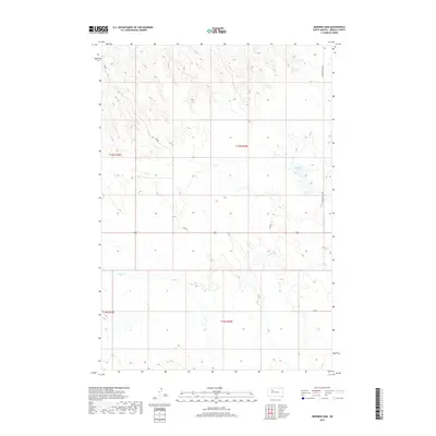
2017 Map of Bedners Dam
USGS Topo · Published 2017About this map
Elm Cr meanders through the heart of the Ziebach County plains, defining the drainage patterns of this sparsely populated corner of District 1. The terrain is structured by the Public Land Survey System, with the intersection of t13n r19e, t13n r20e, t12n r19e, and t12n r20e clearly demarcated. The landscape is characterized by its wide, open spaces where water management is critical, as evidenced by the namesake Bedners Dam in the northeast. Transportation across these sections relies on a few primary corridors, including Thunder Butte Rd and various unnamed connectors like Uc Rd. The presence of several Prv Rd labels indicates a patchwork of private access points and ranching infrastructure typical of the western South Dakota prairie.
Find a feature on this map
9 named features on this map. Tap any name to fly to it.
Don’t see what you’re looking for? This feature index may not catch every label — zoom into the map to look around manually.
Map Details
Editions of this 2017 Bedners Dam Map
This is the sole edition of this map. No revisions or reprints were ever made.
Other maps of this area

1951 · Redelm NE
USGS Topo · 1:24,000

1951 · Dupree NE
USGS Topo · 1:24,000

1951 · Thunder Butte
USGS Topo · 1:24,000

1953 · McIntosh
USGS Topo · 1:250,000

1954 · Pierre
USGS Topo · 1:250,000

1958 · Pierre
USGS Topo · 1:250,000

1958 · McIntosh
USGS Topo · 1:250,000

1979 · Dupree
USGS Topo · 1:25,000

1982 · Bull Creek 2 NE
USGS Topo · 1:24,000

1982 · Miller Dam
USGS Topo · 1:24,000