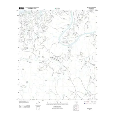
2013 Map of Bee Cave
USGS Topo · Published 2013About this map
The Colorado River and its major impoundments, Lake Travis and Lake Austin, dominate this early 21st-century landscape west of Austin. Significant residential growth is evident in the incorporated communities of Lakeway and The Hills, where dense street networks and the Lakeway Airpark contrast with the rugged, undeveloped expanses of the Shield Ranch to the south. Numerous named hollows and hills, such as Spillman Hollow and Flint Rock Hill, reveal the complex topography of the Balcones Escarpment. Historical traces remain visible through small family burial grounds like Darter Cem and White Rock Cem, and the presence of a Trading Post near the village of Bee Cave. The map captures a moment when traditional ranching properties were increasingly interspersed with suburban development along corridors like Bee Cave Pkwy and Ranch Road 620 N.
Find a feature on this map
50 named features on this map. Tap any name to fly to it.
Don’t see what you’re looking for? This feature index may not catch every label — zoom into the map to look around manually.
Map Details
Editions of this 2013 Bee Cave Map
This is the sole edition of this map. No revisions or reprints were ever made.
Other maps of this area

1887 · Blanco
USGS Topo · 1:125,000

1894 · Blanco
USGS Topo · 1:125,000

1896 · Austin
USGS Topo · 1:125,000

1897 · Austin
USGS Topo · 1:125,000

1910 · Austin
USGS Topo · 1:125,000

1930 · Austin-2
USGS Topo · 1:48,000

1930 · Blanco-1
USGS Topo · 1:48,000

1932 · Mt. Bonnell
USGS Topo · 1:62,500

1954 · Austin West
USGS Topo · 1:24,000

1954 · Llano
USGS Topo · 1:250,000