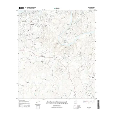
2016 Map of Bee Cave
USGS Topo · Published 2016About this map
Bee Cave serves as a central hub in this landscape where the Texas Hill Country meets the expanding suburban reaches of western Travis County. The terrain is defined by a dense network of creek drainages, most notably the winding paths of Little Barton Cr and Barton Cr which carve through numerous hollows like Hebbington Hollow and Spillman Hollow. To the north, the waters of Lake Travis and the Hurst Creek Arm frame the residential developments of Lakeway and The Hills, where Lakeway Airpark provides a focal point for local aviation. Historic footprints are preserved in the form of local burial grounds such as White Rock Cem, Roberts Cem, and Darter Cem, which sit alongside geographic landmarks like Round Mtn and the narrow Saddle Back Pass. The map also details the hydrology of the region, from the spring-fed Thomas Springs to the branching reaches of Short Spring Br and Myrtle Cr.
Find a feature on this map
230 named features on this map. Tap any name to fly to it.
Don’t see what you’re looking for? This feature index may not catch every label — zoom into the map to look around manually.
Map Details
Editions of this 2016 Bee Cave Map
This is the sole edition of this map. No revisions or reprints were ever made.
Other maps of this area

1887 · Blanco
USGS Topo · 1:125,000

1894 · Blanco
USGS Topo · 1:125,000

1896 · Austin
USGS Topo · 1:125,000

1897 · Austin
USGS Topo · 1:125,000

1910 · Austin
USGS Topo · 1:125,000

1930 · Austin-2
USGS Topo · 1:48,000

1930 · Blanco-1
USGS Topo · 1:48,000

1932 · Mt. Bonnell
USGS Topo · 1:62,500

1954 · Austin West
USGS Topo · 1:24,000

1954 · Llano
USGS Topo · 1:250,000