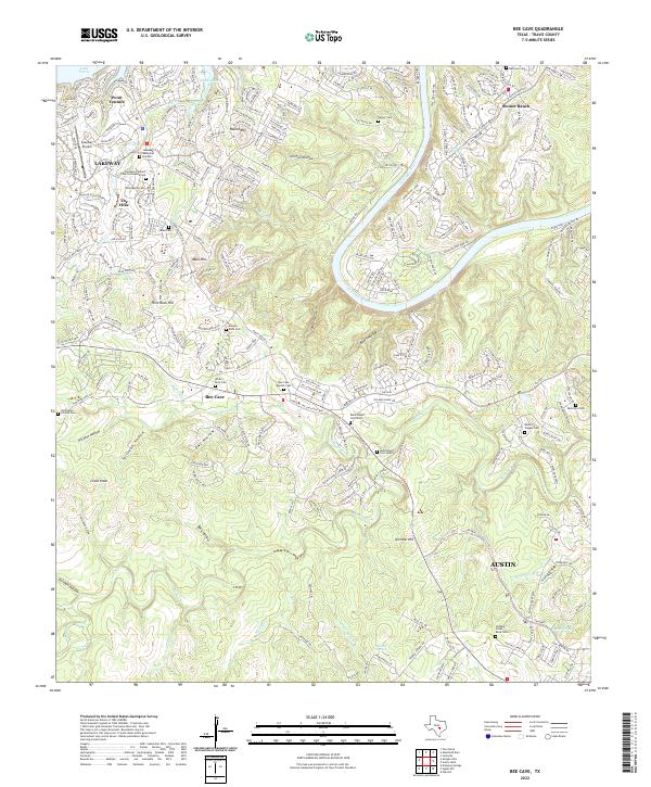
2022 Map of Bee Cave
USGS Topo · Published 2022About this map
Barton Creek and the winding Colorado River define this segment of the Texas Hill Country as it appeared in 2022. The landscape shows a mix of residential expansion and preserved ranching history, evidenced by the numerous family burial grounds scattered across the terrain. Genealogists can trace sites such as Bohls Ranch Cem North and Bohls Ranch Cem South, alongside the Old Bee Caves Road Cem and Roberts Teague Cem. The area around Bee Cave serves as a junction for local travelers, while the waterfront developments of Lakeway and Point Venture take advantage of the jagged shoreline of Lake Travis, specifically the Hurst Creek Arm. Inland, the geography is marked by distinctive elevations like Chalk Knob and Flint Rock Hill, separated by deep cuts such as Bohls Hollow and Spillman Hollow, illustrating the limestone-cut topography typical of this Travis County region.
Find a feature on this map
268 named features on this map. Tap any name to fly to it.
Don’t see what you’re looking for? This feature index may not catch every label — zoom into the map to look around manually.
Map Details
Editions of this 2022 Bee Cave Map
This is the sole edition of this map. No revisions or reprints were ever made.
Other maps of this area

1887 · Blanco
USGS Topo · 1:125,000

1894 · Blanco
USGS Topo · 1:125,000

1896 · Austin
USGS Topo · 1:125,000

1897 · Austin
USGS Topo · 1:125,000

1910 · Austin
USGS Topo · 1:125,000

1930 · Austin-2
USGS Topo · 1:48,000

1930 · Blanco-1
USGS Topo · 1:48,000

1932 · Mt. Bonnell
USGS Topo · 1:62,500

1954 · Austin West
USGS Topo · 1:24,000

1954 · Llano
USGS Topo · 1:250,000