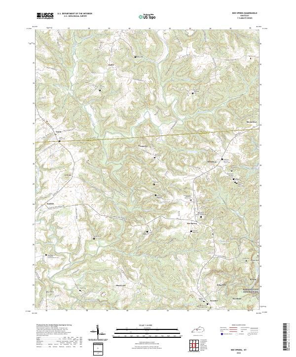
2022 Map of Bee Spring
USGS Topo · Published 2022About this map
The hills of Edmonson County meet the northern boundaries of Mammoth Cave National Park in this detailed survey of Bee Spring. The landscape is defined by the winding Nolin River and a dense network of family-named cemeteries and rural churches that speak to the deep genealogical roots of the region. Distinctive settlements such as Black Gold, Sweeden, and Prosperity are linked by a complex web of creek-side roads and ridges, where features like Dismal Rock and Little Mtn rise above the drainage of Beaverdam Cr.
Find a feature on this map
132 named features on this map. Tap any name to fly to it.
Don’t see what you’re looking for? This feature index may not catch every label — zoom into the map to look around manually.
Map Details
Editions of this 2022 Bee Spring Map
This is the sole edition of this map. No revisions or reprints were ever made.
Other maps of this area

1922 · Leitchfield
USGS Topo · 1:48,000

1922 · Brownsville
USGS Topo · 1:62,500

1922 · Mammoth Cave
USGS Topo · 1:62,500

1923 · Mammoth Cave
USGS Topo · 1:62,500

1923 · Brownsville
USGS Topo · 1:62,500

1925 · Cub Run
USGS Topo · 1:62,500

1925 · Leitchfield
USGS Topo · 1:62,500

1953 · Ready
USGS Topo · 1:24,000

1953 · Bee Spring
USGS Topo · 1:24,000

1954 · Evansville
USGS Topo · 1:250,000