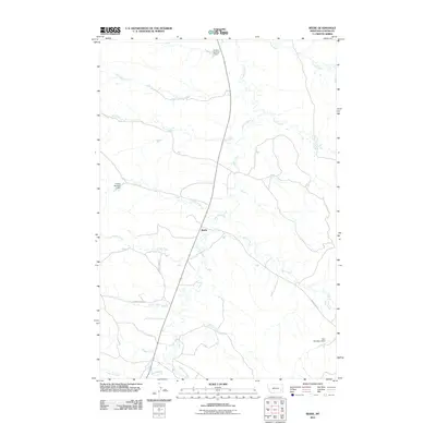
2011 Map of Beebe
USGS Topo · Published 2011About this map
Beebe stands as the central reference point in this corner of Custer County, where the landscape is defined by the winding course of Pumpkin Creek. The drainage patterns of this high-plains terrain are meticulously captured, showing a complex network of seasonal waterways including Jim Creek, Rough Creek, and LaGrange Creek that feed into the larger creek systems. These waterways are essential to the regional ranching and agricultural life, as evidenced by several managed water features like the Hanson Number 1 Dam and Tonn Number 3 Dam. Human presence is marked by a sparse but critical network of rural routes, primarily Rough Creek Rd, Cabin Creek Rd, and Powderville Rd, which connect the isolated homesteads and ranching operations. The map provides a clear look at how water management and topography have dictated the layout of this Montana territory.
Find a feature on this map
19 named features on this map. Tap any name to fly to it.
Don’t see what you’re looking for? This feature index may not catch every label — zoom into the map to look around manually.
Map Details
Editions of this 2011 Beebe Map
This is the sole edition of this map. No revisions or reprints were ever made.
Other maps of this area

1953 · Miles City
USGS Topo · 1:250,000

1954 · Ekalaka
USGS Topo · 1:250,000

1956 · Ekalaka
USGS Topo · 1:250,000

1957 · Miles City
USGS Topo · 1:250,000

1958 · Miles City
USGS Topo · 1:250,000

1958 · Ekalaka
USGS Topo · 1:250,000

1965 · Ekalaka
USGS Topo · 1:250,000

1969 · Horse Creek
USGS Topo · 1:24,000

1969 · First Creek
USGS Topo · 1:24,000

1969 · Loaf of Bread Butte
USGS Topo · 1:24,000