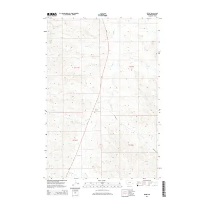
2014 Map of Beebe
USGS Topo · Published 2014About this map
Beebe sits at a geographic junction in Custer County where MT-59 meets the historic Powderville Rd. This remote landscape is defined by the dendritic drainage patterns of Pumpkin Creek and its many tributaries, which carve through the high plains. The map reveals a series of named watercourses including LaGrange Creek, Rough Creek, and Cabin Creek, reflecting the importance of water sources in this cattle country. The surveyor's grid of t4n r49e and adjacent townships provides the structural framework for this section of eastern Montana. Other smaller drainages like Maggie Creek, Jim Creek, and Fire Creek illustrate the dissected nature of the terrain, offering a clear view of the complex topography that characterizes the region west of the Powder River.
Find a feature on this map
19 named features on this map. Tap any name to fly to it.
Don’t see what you’re looking for? This feature index may not catch every label — zoom into the map to look around manually.
Map Details
Editions of this 2014 Beebe Map
This is the sole edition of this map. No revisions or reprints were ever made.
Other maps of this area

1953 · Miles City
USGS Topo · 1:250,000

1954 · Ekalaka
USGS Topo · 1:250,000

1956 · Ekalaka
USGS Topo · 1:250,000

1957 · Miles City
USGS Topo · 1:250,000

1958 · Miles City
USGS Topo · 1:250,000

1958 · Ekalaka
USGS Topo · 1:250,000

1965 · Ekalaka
USGS Topo · 1:250,000

1969 · Horse Creek
USGS Topo · 1:24,000

1969 · First Creek
USGS Topo · 1:24,000

1969 · Loaf of Bread Butte
USGS Topo · 1:24,000