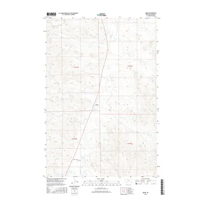
2017 Map of Beebe
USGS Topo · Published 2017About this map
Beebe stands as the primary namesake settlement in this corner of Custer County, situated along the winding course of Pumpkin Cr. The landscape is defined by an intricate network of drainage systems, where seasonal waterways like LaGrange Cr and Rough Cr carve through the terrain. The presence of Beaver Slide Ranch Rd in the southern portion of the map suggests a rural infrastructure tied to the region's ranching heritage. Several other creeks, including Cabin Cr, Maggie Cr, and Chinnick Cr, provide a detailed look at the local hydrology that has historically dictated land use and settlement patterns in this part of Montana. The map also delineates township and range boundaries such as t4n r49e and t4n r50e, essential for researchers tracing land patents and historical property lines.
Find a feature on this map
19 named features on this map. Tap any name to fly to it.
Don’t see what you’re looking for? This feature index may not catch every label — zoom into the map to look around manually.
Map Details
Editions of this 2017 Beebe Map
This is the sole edition of this map. No revisions or reprints were ever made.
Other maps of this area

1953 · Miles City
USGS Topo · 1:250,000

1954 · Ekalaka
USGS Topo · 1:250,000

1956 · Ekalaka
USGS Topo · 1:250,000

1957 · Miles City
USGS Topo · 1:250,000

1958 · Miles City
USGS Topo · 1:250,000

1958 · Ekalaka
USGS Topo · 1:250,000

1965 · Ekalaka
USGS Topo · 1:250,000

1969 · Horse Creek
USGS Topo · 1:24,000

1969 · First Creek
USGS Topo · 1:24,000

1969 · Loaf of Bread Butte
USGS Topo · 1:24,000