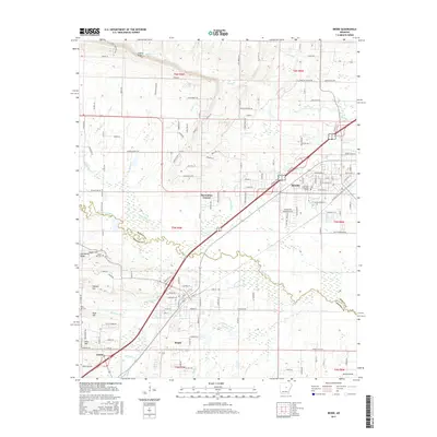
2017 Map of Beebe
USGS Topo · Published 2017About this map
The city of Beebe anchors this landscape in White and Lonoke counties, centered around the Arkansas State Univ -Beebe campus and a dense network of local streets such as Railroad St and W Mississippi St. The area transitions from the structured residential corridors of Lynnwood Acres and Gibbons Ests into the varied topography of Cadron Ridge and Turkey Mountain. To the south, the settlements of Ward and Austin show significant development along the arterial highways.
Find a feature on this map
140 named features on this map. Tap any name to fly to it.
Don’t see what you’re looking for? This feature index may not catch every label — zoom into the map to look around manually.
Map Details
Editions of this 2017 Beebe Map
This is the sole edition of this map. No revisions or reprints were ever made.
Other maps of this area

1891 · Little Rock
USGS Topo · 1:125,000

1893 · Little Rock
USGS Topo · 1:125,000

1940 · Lonoke
USGS Topo · 1:62,500

1941 · Cabot
USGS Topo · 1:31,680

1948 · Helena
USGS Topo · 1:250,000

1949 · Lonoke
USGS Topo · 1:62,500

1950 · Helena
USGS Topo · 1:250,000

1950 · Lonoke
USGS Topo · 1:62,500

1953 · Memphis
USGS Topo · 1:250,000
1954 · Cabot
USGS Topo · 1:24,000