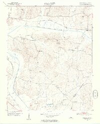
1953 Map of Beech Bluff
USGS Topo · Published 1955About this map
Beech Bluff serves as the primary hub in this West Tennessee landscape, situated along the Nashville Chattanooga and St Louis rail line. The terrain is defined by the convergence of the North Fork Forked Deer River and the South Fork Forked Deer River, creating a well-watered agricultural district. Local social life is anchored by an exceptionally dense network of rural institutions, including Beech Bluff Sch and Harts Sch, alongside numerous houses of worship such as Potts Chapel, Isaac Chapel, and Zion Hill Ch.
Find a feature on this map
39 named features on this map. Tap any name to fly to it.
Don’t see what you’re looking for? This feature index may not catch every label — zoom into the map to look around manually.
Map Details
Editions of this 1953 Beech Bluff Map
3 editions found
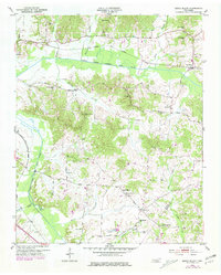
Other maps of this area

1950 · Jackson South
USGS Topo · 1:24,000

1950 · Jackson North
USGS Topo · 1:24,000

1951 · Jackson North
USGS Topo · 1:24,000

1953 · Claybrook
USGS Topo · 1:24,000

1953 · Beech Bluff
USGS Topo · 1:24,000

1955 · Luray
USGS Topo · 1:24,000

1955 · Juno
USGS Topo · 1:24,000

1956 · Blytheville
USGS Topo · 1:250,000

1959 · Blytheville
USGS Topo · 1:250,000

1961 · Medon
USGS Topo · 1:24,000