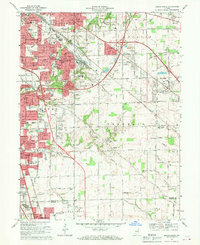
1967 Map of Beech Grove
USGS Topo · Published 1969About this map
The southeastern suburban expansion of Indianapolis takes center stage in the late 1960s, defined by the industrial and railroad footprint of Beech Grove. The massive rail yard of the Penn Central dominates the central terrain, while the residential growth of Southport and Greenwood begins to fill the space between the city and the rural outskirts of Franklin and Pleasant townships. This era shows the transition from a landscape of scattered farms and small airfields like Skyway Airport to a more densely populated suburban corridor.
Find a feature on this map
86 named features on this map. Tap any name to fly to it.
Don’t see what you’re looking for? This feature index may not catch every label — zoom into the map to look around manually.
Map Details
Editions of this 1967 Beech Grove Map
4 editions found
Other maps of this area

1948 · Indianapolis East
USGS Topo · 1:24,000

1948 · Maywood
USGS Topo · 1:24,000

1948 · Beech Grove
USGS Topo · 1:24,000

1948 · Indianapolis West
USGS Topo · 1:24,000

1952 · Cumberland
USGS Topo · 1:24,000

1952 · Bargersville
USGS Topo · 1:24,000

1953 · Greenwood
USGS Topo · 1:24,000

1953 · Acton
USGS Topo · 1:24,000

1953 · Boggstown
USGS Topo · 1:24,000

1953 · Cincinnati
USGS Topo · 1:250,000
Featured Places
- Indianapolis, IN
- Greenwood, IN
- Beech Grove, Indianapolis
- Homecroft, Indianapolis
- Ingallston, Beech Grove