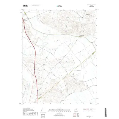
2019 Map of Beech Grove
USGS Topo · Published 2019About this map
The Green River carves a winding path through the northern reaches of this landscape, separating the higher ground of Coltharpe Hills and Wrightsburg Hill from the lowlands to the south. This area, where McLean, Webster, and Hopkins counties converge, is defined by small agricultural settlements and a network of rural roads that follow the contours of the drainage basins. Wrightsburg sits prominently on the southern bank of the river, while the community of Onton serves as a central point for local families, evidenced by the clustered Onton Cem and Old Onton Cem. Farther south, the terrain becomes more dissected by tributaries like Pitman Cr and Sugar Camp Cr. Notable family and community landmarks, such as Samuels Cem and Sassafras Grove Cem, are scattered throughout the countryside, marking the long-standing roots of residents in this river-bottom and hill country.
Find a feature on this map
66 named features on this map. Tap any name to fly to it.
Don’t see what you’re looking for? This feature index may not catch every label — zoom into the map to look around manually.
Map Details
Editions of this 2019 Beech Grove Map
This is the sole edition of this map. No revisions or reprints were ever made.
Other maps of this area

1906 · Sebree
USGS Topo · 1:62,500

1907 · Earlington
USGS Topo · 1:48,000

1908 · Calhoun
USGS Topo · 1:62,500

1909 · Earlington
USGS Topo · 1:62,500

1909 · Madisonville
USGS Topo · 1:62,500

1949 · Sebree
USGS Topo · 1:24,000

1949 · Robards
USGS Topo · 1:24,000

1951 · Sebree
USGS Topo · 1:24,000

1951 · Robards
USGS Topo · 1:24,000

1952 · Sacramento
USGS Topo · 1:24,000