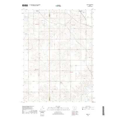
2018 Map of Beech
USGS Topo · Published 2018About this map
Pleasantville anchors the northeast corner of this Marion and Warren County landscape, where the prairie topography is deeply incised by the drainage systems of White Breast Creek and Coon Cr. The 2018 survey reveals a rural structure defined by small settlements like Beech and the community at Caloma, connected by a grid of named local roads such as Jesup Trl and Kirkwood St. For genealogists and local historians, the map preserves the locations of several burial grounds including Highland Cem, Motor Cem, and Coloma Cem, which sit as quiet landmarks amidst the agricultural plots. The hydrology of the area is distinct, with numerous smaller tributaries like Coal Cr, Fly Cr, and Hawk Run carving through the townships of t76n r22w and t75n r21w.
Find a feature on this map
38 named features on this map. Tap any name to fly to it.
Don’t see what you’re looking for? This feature index may not catch every label — zoom into the map to look around manually.
Map Details
Editions of this 2018 Beech Map
This is the sole edition of this map. No revisions or reprints were ever made.
Other maps of this area

1909 · Knoxville
USGS Topo · 1:62,500

1910 · Milo
USGS Topo · 1:62,500

1912 · Knoxville
USGS Topo · 1:62,500

1918 · Chariton
USGS Topo · 1:62,500

1924 · Melcher
USGS Topo · 1:62,500

1954 · Des Moines
USGS Topo · 1:250,000

1956 · Des Moines
USGS Topo · 1:250,000

1957 · Des Moines
USGS Topo · 1:250,000

1965 · Pleasantville
USGS Topo · 1:24,000

1965 · Milo
USGS Topo · 1:24,000
Featured Places
- Pleasantville, IA
- Franklin Township, IA
- Union Township, IA
- Belmont Township, IA
- Pleasant Grove Township, IA