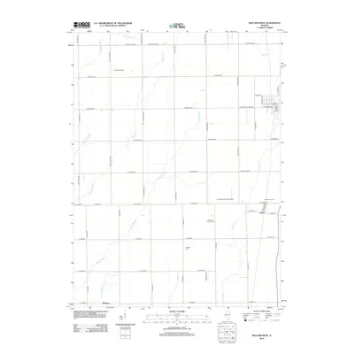
2012 Map of Beecher West
USGS Topo · Published 2012About this map
Sollitt and Whitaker anchor the eastern and southern reaches of this landscape, reflecting the agricultural and small-town character of Will County in the early 21st century. The terrain is defined by a complex network of drainage systems, including Exline Slough, Trim Cr, and Marshall Slough, which weave between a rigid grid of country roads and farm properties like Disselkoen Farms. Local history is preserved at Saint Paul Lutheran Cem and Heusing Cem, while the region's aviation interests are marked by private landing strips such as Norman Airport and Von Alvens Airview Airport. The map shows a transition from structured town parcels near the Beecher vicinity to the expansive fields of the Illinois prairie, providing a detailed look at land use patterns and rural infrastructure.
Find a feature on this map
52 named features on this map. Tap any name to fly to it.
Don’t see what you’re looking for? This feature index may not catch every label — zoom into the map to look around manually.
Map Details
Editions of this 2012 Beecher West Map
This is the sole edition of this map. No revisions or reprints were ever made.
Other maps of this area

1922 · Momence
USGS Topo · 1:62,500

1922 · Kankakee
USGS Topo · 1:62,500

1924 · Momence
USGS Topo · 1:62,500

1924 · Kankakee
USGS Topo · 1:62,500

1929 · Dyer
USGS Topo · 1:24,000

1930 · Dyer
USGS Topo · 1:24,000

1930 · Frankfort
USGS Topo · 1:24,000

1930 · Steger
USGS Topo · 1:24,000

1949 · Peotone
USGS Topo · 1:62,500

1949 · Crete
USGS Topo · 1:62,500