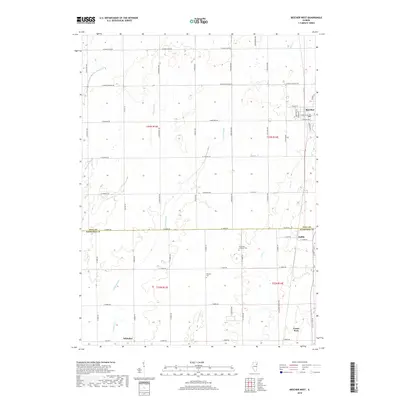
2018 Map of Beecher West
USGS Topo · Published 2018About this map
The agricultural landscape along the Will Co Kankakee Co border is defined by a complex network of drainage features and small rural settlements. Small communities like Sollitt, Whitaker, and the northern edge of Grant Park are connected by a rigid grid of country roads such as S Egyptian Trl and E 12000N Rd. The terrain is shaped by several watercourses and managed drainage ways, including Exline Slough, Marshall Slough, and Black Walnut Cr. Local history is anchored by sites such as the Saint Paul Lutheran Cem and Heusing Cem, which serve as permanent markers of the area's early settlement. Near the town of Beecher, the intersection of Penfield St and W Indiana Ave marks a local activity hub, while the surrounding townships remain dedicated to a rural, water-managed geography.
Find a feature on this map
55 named features on this map. Tap any name to fly to it.
Don’t see what you’re looking for? This feature index may not catch every label — zoom into the map to look around manually.
Map Details
Editions of this 2018 Beecher West Map
This is the sole edition of this map. No revisions or reprints were ever made.
Other maps of this area

1922 · Momence
USGS Topo · 1:62,500

1922 · Kankakee
USGS Topo · 1:62,500

1924 · Momence
USGS Topo · 1:62,500

1924 · Kankakee
USGS Topo · 1:62,500

1929 · Dyer
USGS Topo · 1:24,000

1930 · Dyer
USGS Topo · 1:24,000

1930 · Frankfort
USGS Topo · 1:24,000

1930 · Steger
USGS Topo · 1:24,000

1949 · Peotone
USGS Topo · 1:62,500

1949 · Crete
USGS Topo · 1:62,500