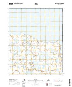
2017 Map of Beechey Point A-1 NW
USGS Topo · Published 2017About this map
Foggy Island Bay dominates the northern coast of this Arctic landscape, where the waters of the Beaufort Sea meet the low-lying wetlands of the North Slope. The terrain is a complex network of seasonal lakes and ponds, typical of the permafrost-affected coastal plain. The Shaviovik River flows through the eastern portion of the quadrangle, reaching the coast just south of the bay. A prominent topographic landmark, the Shaviovik Mound, rises above the surrounding flatlands, providing a rare point of elevation in a region defined by horizontal expanses and water. This survey captures the area within the Arctic coastal ecosystem, documenting the intricate hydrology before the shifting cycles of the far north alter the shoreline and river paths further.
Find a feature on this map
8 named features on this map. Tap any name to fly to it.
Don’t see what you’re looking for? This feature index may not catch every label — zoom into the map to look around manually.
Map Details
Editions of this 2017 Beechey Point A-1 NW Map
This is the sole edition of this map. No revisions or reprints were ever made.
Other maps of this area

1951 · Beechey Point
USGS Topo · 1:250,000

1955 · Beechey Point
USGS Topo · 1:250,000

1955 · Beechey Point B-2
USGS Topo · 1:63,360

1955 · Beechey Point B-1
USGS Topo · 1:63,360

1955 · Beechey Point A-1
USGS Topo · 1:63,360

1955 · Beechey Point A-2
USGS Topo · 1:63,360

1960 · Beechey Point
USGS Topo · 1:250,000
1962 · Beechey Point A-1
USGS Topo · 1:50,000

1962 · Beechey Point B-2
USGS Topo · 1:50,000
1962 · Beechey Point B-1
USGS Topo · 1:50,000