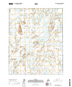
2017 Map of Beechey Point A-2 NW
USGS Topo · Published 2017About this map
Hydrological patterns and seasonal wetlands dominate this Arctic landscape along the northern edge of the state. This 2017 survey illustrates the complex drainage systems typical of the North Slope, where the terrain is almost entirely defined by water bodies and braided channels rather than human infrastructure or permanent settlements. The sheet spans across the survey boundaries of T10n R16e, T10n R17e, T9n R16e, and T9n R17e, providing a detailed view of the natural contours and water flow within these specific townships. The lack of roads or established buildings emphasizes the preservation of the native landscape, making it a valuable resource for understanding the environmental geography of the region before any significant industrial or infrastructure shifts in the modern era.
Find a feature on this map
4 named features on this map. Tap any name to fly to it.
Don’t see what you’re looking for? This feature index may not catch every label — zoom into the map to look around manually.
Map Details
Editions of this 2017 Beechey Point A-2 NW Map
This is the sole edition of this map. No revisions or reprints were ever made.
Other maps of this area

1951 · Beechey Point
USGS Topo · 1:250,000

1955 · Beechey Point
USGS Topo · 1:250,000

1955 · Beechey Point B-2
USGS Topo · 1:63,360

1955 · Beechey Point A-2
USGS Topo · 1:63,360

1955 · Beechey Point A-3
USGS Topo · 1:63,360

1955 · Beechey Point B-3
USGS Topo · 1:63,360

1960 · Beechey Point
USGS Topo · 1:250,000

1962 · Beechey Point B-2
USGS Topo · 1:50,000
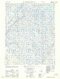
1962 · Beechey Point A-2
USGS Topo · 1:50,000

1964 · Beechey Point
USGS Topo · 1:250,000