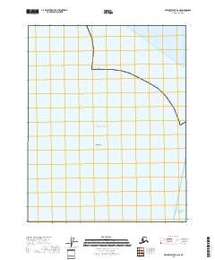
2018 Map of Beechey Point B-2 NE
USGS Topo · Published 2018About this map
Dinkum Sands sits at the center of this maritime survey, a small feature within the expansive waters of the Arctic Ocean. Located in the extreme northern reaches of the North Slope, the map illustrates the boundary where the continental shelf meets the Beaufort Sea. The survey details the Public Land Survey System grid sections for townships t12n r17e, t12n r18e, and t13n r16e, providing a precise look at the legal geography of this remote coastal area. Unlike inland quadrangles, this sheet focuses almost entirely on the coastline and nearshore environment where the Alaskan landmass gives way to the sea.
Find a feature on this map
6 named features on this map. Tap any name to fly to it.
Don’t see what you’re looking for? This feature index may not catch every label — zoom into the map to look around manually.
Map Details
Editions of this 2018 Beechey Point B-2 NE Map
This is the sole edition of this map. No revisions or reprints were ever made.
Other maps of this area

1951 · Beechey Point
USGS Topo · 1:250,000

1955 · Beechey Point
USGS Topo · 1:250,000

1955 · Beechey Point B-2
USGS Topo · 1:63,360

1955 · Beechey Point B-1
USGS Topo · 1:63,360

1960 · Beechey Point
USGS Topo · 1:250,000

1962 · Beechey Point B-2
USGS Topo · 1:50,000
1962 · Beechey Point B-1
USGS Topo · 1:50,000

1964 · Beechey Point
USGS Topo · 1:250,000
1970 · Beechey Point B-2 SE
USGS Topo · 1:24,000
1970 · Beechey Point B-2 SW
USGS Topo · 1:24,000