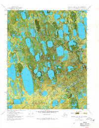
1970 Map of Beechey Point B-3 SW
USGS Topo · Published 1971About this map
The Putuligayuk River snakes through this North Slope landscape, showing the early industrial footprint of the Alaska oil boom shortly after the 1968 discovery. At the heart of the activity is the Discovery Well Prudhoe Bay State No 1, a landmark of American energy history situated near the coast of Prudhoe Bay. The orthophotomap format reveals the complex network of thaw lakes and wetlands that define the tundra, interspersed with the newly built gravel infrastructure of the era.
Find a feature on this map
20 named features on this map. Tap any name to fly to it.
Don’t see what you’re looking for? This feature index may not catch every label — zoom into the map to look around manually.
Map Details
Editions of this 1970 Beechey Point B-3 SW Map
2 editions found
Other maps of this area

1951 · Beechey Point
USGS Topo · 1:250,000

1955 · Beechey Point
USGS Topo · 1:250,000

1955 · Beechey Point B-4
USGS Topo · 1:63,360

1955 · Beechey Point A-3
USGS Topo · 1:63,360

1955 · Beechey Point A-4
USGS Topo · 1:63,360

1955 · Beechey Point B-3
USGS Topo · 1:63,360

1960 · Beechey Point
USGS Topo · 1:250,000

1962 · Beechey Point B-4
USGS Topo · 1:50,000

1964 · Beechey Point
USGS Topo · 1:250,000
1970 · Beechey Point A-4 NE
USGS Topo · 1:24,000