
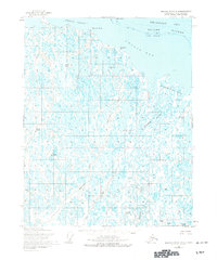
1955 Map of Beechey Point B-4
USGS Topo · Published 1967About this map
Beechey Point stands as a lonely landmark on the edge of the Beaufort Sea in this 1955 survey of the Alaskan North Slope. The landscape is dominated by a complex network of thaw lakes and the intricate braided channels of the Kuparuk River Delta. To the west, the Sakonowyak River meanders toward the coast, while the distinctive Beechey Mound provides a rare point of elevation in the otherwise flat coastal plain. This map was compiled from aerial photography taken in the mid-1950s, a period before the major industrial shifts on the North Slope, showing the geography in its raw, undeveloped state. The shoreline is defined by the sheltered waters of Simpson Lagoon and Gwydyr Bay, protected by the barrier chain of the Return Islands, including Long Island and Cottle Island.
Find a feature on this map
12 named features on this map. Tap any name to fly to it.
Don’t see what you’re looking for? This feature index may not catch every label — zoom into the map to look around manually.
Map Details
Editions of this 1955 Beechey Point B-4 Map
2 editions found
Other maps of this area

1951 · Beechey Point
USGS Topo · 1:250,000

1955 · Beechey Point
USGS Topo · 1:250,000
1955 · Beechey Point C-4
USGS Topo · 1:63,360

1955 · Beechey Point A-5
USGS Topo · 1:63,360

1955 · Beechey Point A-3
USGS Topo · 1:63,360

1955 · Beechey Point A-4
USGS Topo · 1:63,360
1955 · Beechey Point C-5
USGS Topo · 1:63,360

1955 · Beechey Point B-5
USGS Topo · 1:63,360

1955 · Beechey Point B-3
USGS Topo · 1:63,360

1960 · Beechey Point
USGS Topo · 1:250,000