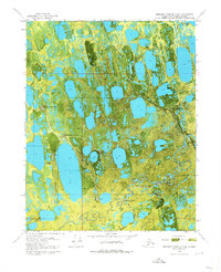
1970 Map of Beechey Point B-3 SW
USGS Topo · Published 1974About this map
The Discovery Well Prudhoe Bay State No 1 anchors this 1970 orthophotomap, marking the early industrial activity along the Arctic coast. This transitional landscape of the North Slope is defined by its extensive thaw lakes and the meandering Putuligayuk River. The transition from seasonal exploration to permanent infrastructure is visible through the emergence of the Spine Road and the established Pipeline corridor.
Find a feature on this map
19 named features on this map. Tap any name to fly to it.
Don’t see what you’re looking for? This feature index may not catch every label — zoom into the map to look around manually.
Map Details
Editions of this 1970 Beechey Point B-3 SW Map
2 editions found
Other maps of this area

1951 · Beechey Point
USGS Topo · 1:250,000

1955 · Beechey Point
USGS Topo · 1:250,000

1955 · Beechey Point B-4
USGS Topo · 1:63,360

1955 · Beechey Point A-3
USGS Topo · 1:63,360

1955 · Beechey Point A-4
USGS Topo · 1:63,360

1955 · Beechey Point B-3
USGS Topo · 1:63,360

1960 · Beechey Point
USGS Topo · 1:250,000

1962 · Beechey Point B-4
USGS Topo · 1:50,000

1964 · Beechey Point
USGS Topo · 1:250,000
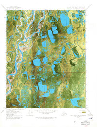
1970 · Beechey Point A-4 NE
USGS Topo · 1:24,000