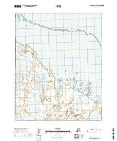
2017 Map of Beechey Point B-4 NE
USGS Topo · Published 2017About this map
Gwydyr Bay dominates this coastal survey, where the Beaufort Sea meets the North Slope. The landscape is defined by a complex network of barrier islands and river deltas, including the Return Islands, Cottle Island, and Long Island which shield the inner waters from the open Arctic ocean. The drainage patterns of the Sakonowyak River and the Kuparak River illustrate a low-lying tundra environment characterized by hundreds of small thaw lakes and shifting aquatic channels. This area, marked by Back Point, showcases the delicate geomorphology of the Alaskan coastline in the early 21st century, providing a clear record of the relationship between these river systems and the protective island chains that define the bay's northern boundary.
Find a feature on this map
11 named features on this map. Tap any name to fly to it.
Don’t see what you’re looking for? This feature index may not catch every label — zoom into the map to look around manually.
Map Details
Editions of this 2017 Beechey Point B-4 NE Map
This is the sole edition of this map. No revisions or reprints were ever made.
Other maps of this area

1951 · Beechey Point
USGS Topo · 1:250,000

1955 · Beechey Point
USGS Topo · 1:250,000
1955 · Beechey Point C-4
USGS Topo · 1:63,360

1955 · Beechey Point B-4
USGS Topo · 1:63,360

1955 · Beechey Point B-3
USGS Topo · 1:63,360

1960 · Beechey Point
USGS Topo · 1:250,000

1962 · Beechey Point B-4
USGS Topo · 1:50,000
1962 · Beechey Point C-4
USGS Topo · 1:50,000

1964 · Beechey Point
USGS Topo · 1:250,000
1970 · Beechey Point B-4 SE
USGS Topo · 1:24,000