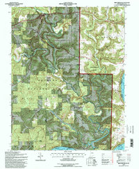
1993 Map of Beechwood
USGS Topo · Published 1998About this map
The Ohio River forms a winding southern boundary for this portion of Crawford County, where the intricate drainage systems of the Blue River and Little Blue River carve through the landscape. This late-twentieth-century revision highlights a region defined by its conservation lands, notably the Hoosier National Forest and Harrison-Crawford State Forest. Small settlements like Sulphur, Beechwood, and Fredonia serve as local anchors amid the forested terrain. Genealogists will find significant value in the numerous documented burial sites, including Sulphur Springs Cem, Old Union Cem, and Orchard Hill Cem. The presence of several country churches, such as Harvey Flat Ch and Pleasant Ridge Ch, illustrates the enduring community nodes that persist even as modern infrastructure like Interstate 64 crosses the northern reaches of the quadrangle.
Find a feature on this map
37 named features on this map. Tap any name to fly to it.
Don’t see what you’re looking for? This feature index may not catch every label — zoom into the map to look around manually.
Map Details
Editions of this 1993 Beechwood Map
This is the sole edition of this map. No revisions or reprints were ever made.
Other maps of this area

1946 · Leavenworth
USGS Topo · 1:24,000

1947 · Leavenworth
USGS Topo · 1:24,000

1948 · Milltown
USGS Topo · 1:24,000

1950 · Beechwood
USGS Topo · 1:24,000

1950 · English
USGS Topo · 1:24,000
1950 · Leavenworth
USGS Topo · 1:24,000
1950 · New Amsterdam
USGS Topo · 1:24,000

1950 · Alton
USGS Topo · 1:62,500

1950 · Alton
USGS Topo · 1:24,000

1951 · Alton
USGS Topo · 1:24,000