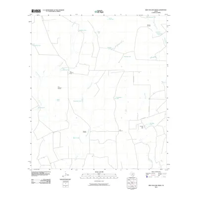
2010 Map of Beef Hollow Creek
USGS Topo · Published 2010About this map
Beef Hollow Creek and Turkey Creek define the arid drainage patterns of this South Texas landscape, where water management is the primary marker of human presence. The distribution of infrastructure reveals a ranching economy reliant on scattered tanks and windmills to sustain operations in Zavala County. Named features like McNalley Windmill and High Lonesome Windmill indicate specific points of groundwater access, while numerous water storage sites such as Chaparrosa Lake and Rutledge Lake show the importance of surface catchment. The presence of High Lonesome Camp and named thoroughfares like Nelson Ranch Rd provide a sense of the remote working settlements and transport routes used by landholders. This 2010 survey offers a clear look at the hydraulic systems, including the Rutledge Lake Dam, necessary for life and industry in this brush-country environment.
Find a feature on this map
28 named features on this map. Tap any name to fly to it.
Don’t see what you’re looking for? This feature index may not catch every label — zoom into the map to look around manually.
Map Details
Editions of this 2010 Beef Hollow Creek Map
This is the sole edition of this map. No revisions or reprints were ever made.
Other maps of this area

1939 · Carrizo Springs
USGS Topo · 1:62,500

1939 · La Pryor
USGS Topo · 1:62,500

1940 · Cometa
USGS Topo · 1:62,500

1940 · Chacon Creek
USGS Topo · 1:62,500

1953 · Crystal City
USGS Topo · 1:250,000

1955 · Crystal City
USGS Topo · 1:250,000

1958 · Eagle Pass
USGS Topo · 1:250,000

1961 · Crystal City
USGS Topo · 1:250,000

1965 · Eagle Pass
USGS Topo · 1:250,000

1968 · Crystal City
USGS Topo · 1:250,000